Stanza · Audio guide
Fortaleza de SagresAudio guide
A place to remember. A story to take with you.
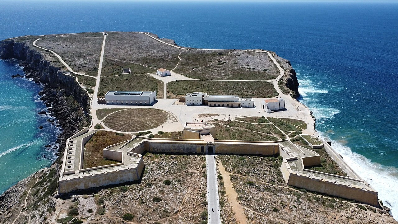
The Fortaleza de Sagres is a historic 15th-century maritime fortress located on the southwesternmost tip of Europe. It is historically associated with Prince Henry the Navigator and the Portuguese Age of…
Download Stanza, then search for “Fortaleza de Sagres”.
About the tour
One guide. Your kind of visit.
The Fortaleza de Sagres is a historic 15th-century maritime fortress located on the southwesternmost tip of Europe. It is historically associated with Prince Henry the Navigator and the Portuguese Age of Discovery.
Ready when you are.
- 01Get the free Stanza app.
iOS & Android
- 02Find your guide.
“Fortaleza de Sagres”
- 03Download before you go.
Works offline
Audio guide / 14 narrated stops
Inside the guide
Get to know a few of the stories before you go. Open a stop to read more.
01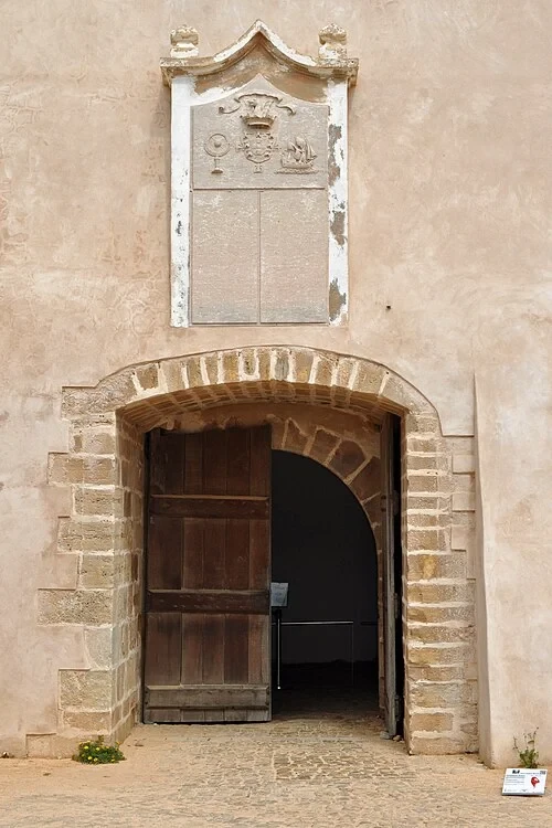 The Neoclassical Portal and RampartsThe Inner Gateway
Welcome to the Sagres Fortress, a site of immense historical importance perched on the southwestern tip of Portugal. As you step into the tunnel of the inner gateway, look up at the weathered stone coat of arms positioned directly above the doorway. This piece of heraldry features three distinct symbols: a caravel, an armillary sphere, and a royal crown. Each element carries deep significance. The caravel was the agile vessel that made long-range ocean travel possible, while the armillary sphere represents the astronomical and navigational sciences pioneered here. These symbols reflect the maritime ambition of the Portuguese Empire during the 15th century and pay homage to Henry the Navigator, the central figure who organized expeditions that forever changed global maps. The masonry arch itself provides a sense of the fortress's defensive strength, acting as a sturdy transition point between the rugged exterior cliffs and the strategic military plateau within. This passage marks the beginning of a journey into the era when Portugal led the world into the Age of Discovery.
Photo: Klugschnacker · CC BY-SA 3.0
02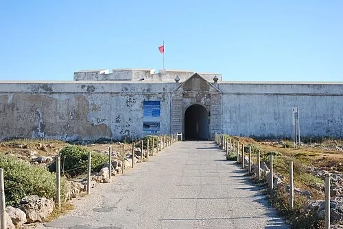 The Neoclassical Portal and RampartsThe Main Entrance Portal
The neoclassical portal before you serves as the primary entrance to what was known in antiquity as the 'Promontorium Sacrum', or Sacred Promontory. While the fortress has medieval roots, this specific architectural feature was constructed in the late 18th century. It replaced the original 15th-century walls that were tragically destroyed during the Great Lisbon Earthquake of 1755. The fortress occupies a massive limestone headland that juts out into the Atlantic, rising 40 meters above the churning sea below. This natural plateau measures approximately one kilometer in length, providing a vast and defensible area for the military installations housed within. Notice the thickness of the walls and the clean lines of the neoclassical design, which contrast with the rugged, weathered landscape of the Cape. The scale of this entrance was intended to communicate the power and resilience of the Portuguese state, rebuilding its defenses even after one of the most devastating natural disasters in European history. From here, the path opens onto the wide, windswept interior of the promontory.
Photo: Concierge.2C · CC BY-SA 3.0
03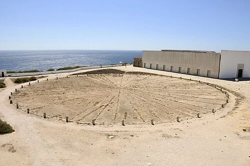 The Rosa dos Ventos (Wind Rose)The Great Wind Rose
On the ground before you lies an enigmatic stone circle measuring 43 meters in diameter. This 32-pointed star is often referred to as the 'Wind Rose' and is central to the legend of the Sagres School. While popular tradition suggests Prince Henry established a formal academy for navigation here, modern historians believe this site was more likely a private administrative base for organizing maritime expeditions. The stones were only discovered in 1921 when the area was being cleared of debris and overgrowth, adding to the site's air of mystery. Each point of the star corresponds to the directions on a compass, a tool that was indispensable to the explorers setting sail from the nearby Algarve coast. The circle is constructed from rough-hewn local stone, laid into the earth of the plateau. Its sheer size suggests it could have been used as a practical tool for teaching navigation or as a symbolic representation of Portugal's global reach. Today, it remains one of the most recognizable and photographed features of the fortress, representing the intersection of historical legend and scientific exploration.
Listen in the appPhoto: CTHOE · CC BY-SA 3.0
04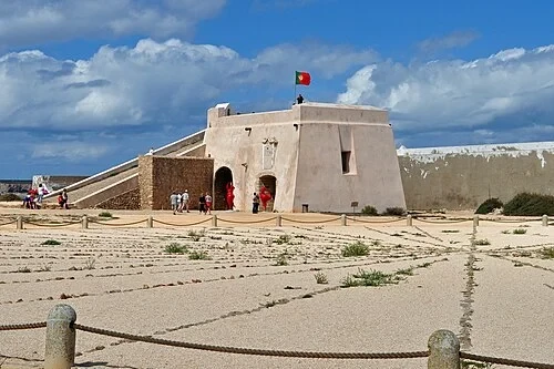 The Rosa dos Ventos (Wind Rose)The Fortified Bastions
Looking out across the interior plateau, the massive bastions and thick curtain walls define the military character of the site. These fortifications were strategically designed to funnel potential attackers into narrow 'kill zones' where they would be vulnerable to defensive fire from multiple angles. This sophisticated approach to military architecture became necessary after a significant historical event in 1587, when the English privateer Sir Francis Drake successfully raided the cape. His attack proved that the original medieval defenses were insufficient against modern naval and land-based artillery. In response, these later, far more massive reinforcements were constructed to ensure the promontory could withstand prolonged sieges. The height and thickness of these walls provide a buffer against the relentless Atlantic winds and sea spray that characterize this environment. Walking along the interior, you can see how the layout maximizes visibility across both the landward approaches and the surrounding ocean. These structures represent centuries of evolution in defensive technology, transforming a natural limestone landmark into an nearly impenetrable military stronghold at the edge of the European continent.
Listen in the appPhoto: Klugschnacker · CC BY-SA 3.0
05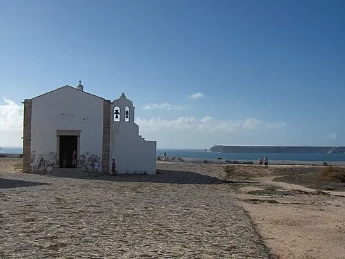 The Church of Nossa Senhora da GraçaChurch of Our Lady of Grace
The Church of Our Lady of Grace represents the spiritual heart of the Sagres promontory. This modest 16th-century structure stands on the site of an even earlier chapel founded by Prince Henry the Navigator during the initial settlement of the cape. Its simple, unadorned white facade was not merely a stylistic choice; it served a practical function as a prominent landmark for sailors navigating the treacherous waters around the point. In an era before modern lighthouses, the gleaming white walls of the church provided a recognizable point of reference during daylight hours. The building’s architecture is intentionally sparse, reflecting the austerity of the military environment and the isolation of this windswept location. Inside, the single nave leads to a small altar, providing a place of quiet reflection for the garrison members who lived and worked here. For centuries, this building was the first and last sign of home for many Portuguese explorers as they embarked on their perilous journeys into the unknown. It remains a rare example of 16th-century religious architecture in the region that survived the seismic shocks of the 1755 earthquake.
Listen in the appGeorges Jansoone · CC BY 2.5
06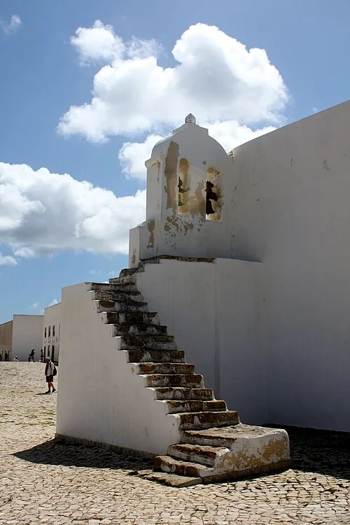 The Church of Nossa Senhora da GraçaThe Church Bell Tower
Attached to the side of the church is a unique exterior belfry, accessible by a set of weathered stone steps. In this isolated and frequently foggy location, the church bells served a purpose far beyond the traditional call to prayer. They were vital communication signals used to warn the garrison of approaching threats or to signal ships struggling to navigate the dangerous currents of the headland. The design of the tower is simple and robust, built to withstand the salt air and high-velocity winds that sweep across the cape daily. The staircase itself shows the wear of centuries of use, with the stones rounded and smoothed by the footsteps of the sentries and monks who once tended the bells. Looking up at the open arches where the bells hang, you can imagine the sound carrying far out over the Atlantic, cutting through the roar of the surf. This belfry highlights the dual nature of life at Sagres, where religious life and military necessity were inextricably linked. The tower stands as a quiet observer of the countless vessels that have rounded this corner of Europe over the last five hundred years.
Listen in the appKyle Taylor from London, 84 Countries · CC BY 2.0
07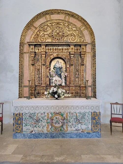 The Sacred Interior and AltarThe Gilded Altarpiece
The interior of the Church of Our Lady of Grace contains a striking 17th-century Mannerist altarpiece, a fine example of gilded wood carving. At the center of the ornate structure is a figure of the Virgin Mary holding the Christ child, a common motif in Portuguese maritime chapels. The intricate gold leaf reflects any available light, creating a stark contrast with the simple, white-washed walls of the building. Look at the base of the altar to find the azulejo tile panels, which are decorated with vibrant depictions of birds and flowers. These tiles provide a rare splash of color and artistic detail in what is otherwise a very utilitarian military setting. The Mannerist style is characterized by its elongated figures and complex, overlapping decorative elements, which you can see in the columns and scrollwork surrounding the central niche. This altarpiece likely provided a sense of comfort and familiarity to the officers and their families stationed at this remote outpost. It remains one of the most significant pieces of historic artwork within the fortress, preserved despite the harsh coastal conditions that have weathered so much of the surrounding exterior stone.
Listen in the appPhoto: Threeohsix · CC BY-SA 4.0
08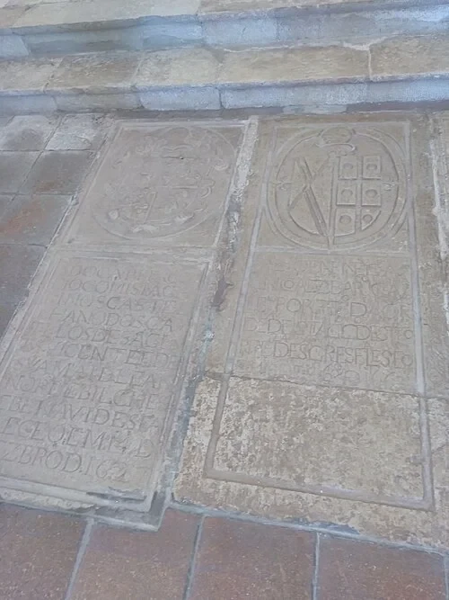 The Sacred Interior and AltarThe Church Floor Tombs
As you walk through the church, your attention may be drawn to the heavy stone slabs embedded in the floor. These inscribed markers are the graves of the fortress commanders and their family members, dating back to the 1600s. Many of the slabs feature intricate Portuguese heraldry, identifying the noble lineages of those who served here. These tombs serve as a poignant reminder that Sagres was not just a temporary military post, but a permanent colony where families lived, worked, and died at the very edge of the continent. The inscriptions are written in archaic Portuguese, documenting the titles and years of service of the men who were responsible for defending this critical maritime gateway. Over the centuries, the footsteps of thousands of visitors have slightly worn down the relief of the carvings, yet the coats of arms remain clearly visible. These floor tombs anchor the site to its human history, connecting the abstract goals of empire and exploration to the individuals who were tasked with maintaining order and security on this isolated limestone headland. They stand as silent witnesses to the generations of military service that defined life at the Cape.
Listen in the appPhoto: Threeohsix · CC BY-SA 4.0
09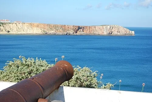 The Defensive Batteries and CannonsThe Ocean-Facing Cannon
Positioned along the seaward edge of the fortress, these rusted iron cannons remain aimed at the horizon of the Atlantic Ocean. Their presence underscores the immense strategic importance of this specific location throughout history. Ships traveling between the Mediterranean Sea and Northern Europe were forced to navigate around the Sagres headland, making it the most critical maritime choke point in Portugal. From this vantage point, a well-placed battery could monitor and control the movement of both merchant fleets and hostile armadas. The iron of these artillery pieces is heavily pitted and oxidized, a testament to centuries of exposure to the corrosive salt spray and moisture of the ocean. Despite their current state, these cannons were once the state-of-the-art technology that allowed the Portuguese to secure their coastlines and protect the valuable cargo returning from overseas territories. Looking down the barrel of one of these guns, you get a clear sense of the clear line of sight the defenders had over the surrounding waters. This artillery was the primary deterrent against the pirates and privateers who once frequented these busy shipping lanes, seeking to intercept the wealth of the Age of Discovery.
Listen in the appPhoto: Concierge.2C · CC BY-SA 3.0
10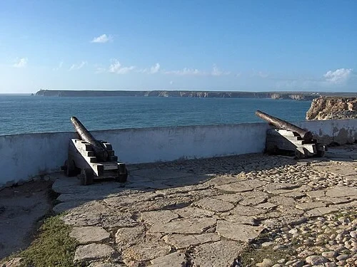 The Defensive Batteries and CannonsThe Cliffside Battery
These cannons, mounted on sturdy wooden carriages, offer a glimpse into the logistical challenges of maintaining a coastal battery. In a salt-saturated and windswept environment like the Sagres promontory, the wood and metal of these weapons required constant maintenance to remain functional. The carriages allowed the heavy barrels to be maneuvered into firing positions or withdrawn for reloading, though moving them across the uneven stone and dirt of the headland was an arduous task. The sheer scale of the defensive effort here is impressive; even today, the site draws significant interest for its well-preserved military heritage. In 2018 alone, nearly half a million people visited the fortress to walk among these defenses and experience the rugged landscape. The battery was positioned to cover the gaps where the natural cliffs were less vertical, preventing enemy landing parties from scaling the headland. While these specific guns are now silent artifacts, they represent a long history of maritime security that kept the Portuguese coast safe for centuries. The surrounding walls and the placement of these batteries reflect a sophisticated understanding of both ballistics and the unique topography of the limestone cape.
Listen in the appGeorges Jansoone · CC BY 2.5
Fortaleza de Sagres
Frequently asked questions
How much does the guide cost?
Free app download. Listed guide price: $3.99. Guide price shown in the app. Audio guide only. Venue admission is separate.
Can I listen without internet?
Yes. Download the guide’s audio, images, and maps in the app before your visit. Your downloaded content is then available offline.
Can I listen in my language?
Stanza supports 15 languages. Check the app for the languages available for this guide.
Do I need to follow a schedule?
No. This is a self-guided experience. Choose your stops, pause whenever you like, and return to a story at your own pace.
At your own pace
Explore Fortaleza de Sagres.
Download Stanza, then search for “Fortaleza de Sagres”.
Free app download · Guide price shown in the app
Keep exploring
Nearby audio guides
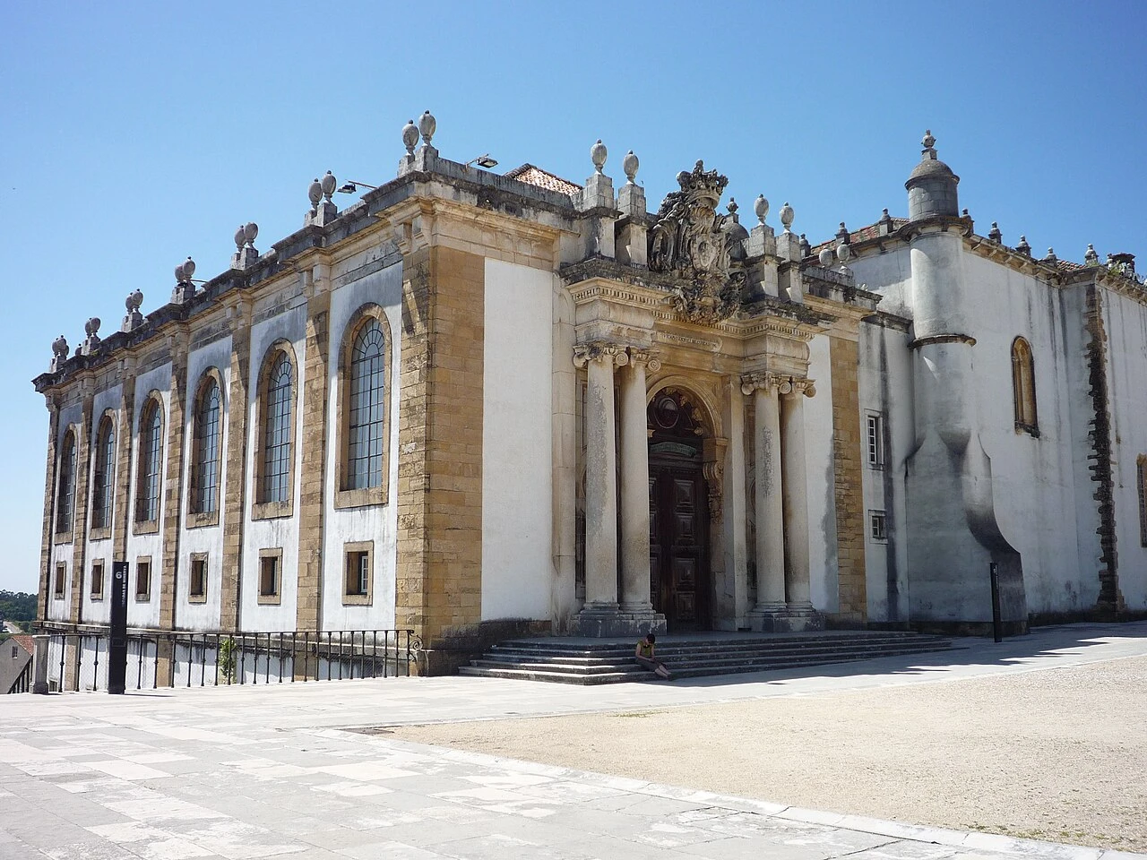
Coimbra
Biblioteca Joanina
Content & sources
Chris · CC BY-SA 2.0
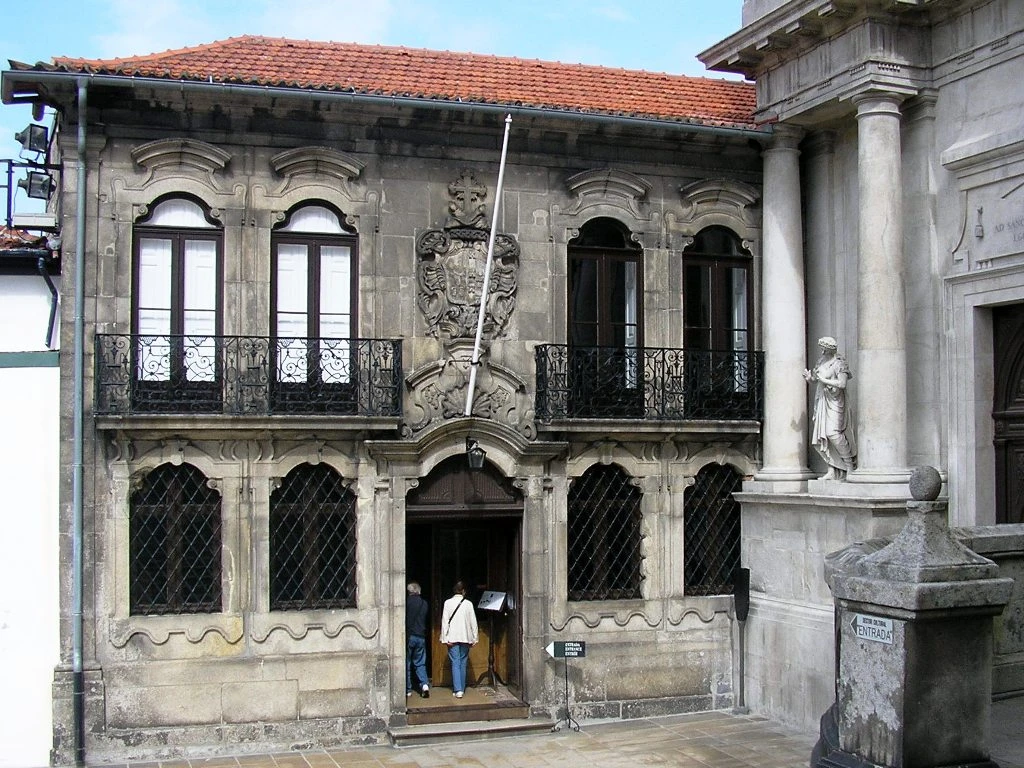
Porto
Casa do Despacho da Venerável Ordem Terceira de São Francisco
Content & sources
Photo: Manuel de Sousa · CC BY-SA 3.0
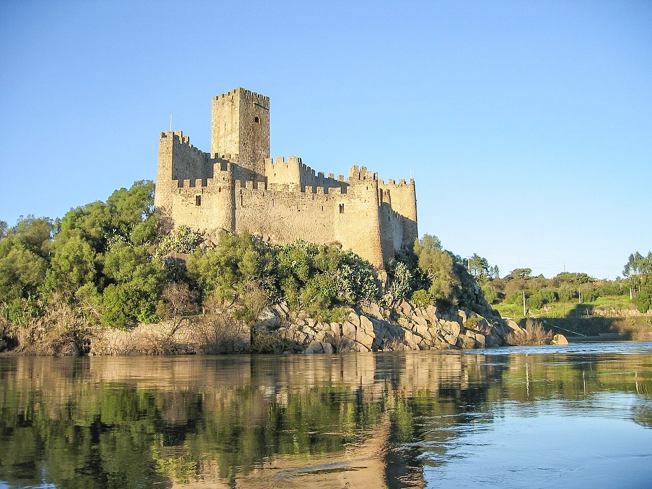
Praia do Ribatejo
Castelo de Almourol
Content & sources
Daniel Feliciano · CC BY-SA 2.5
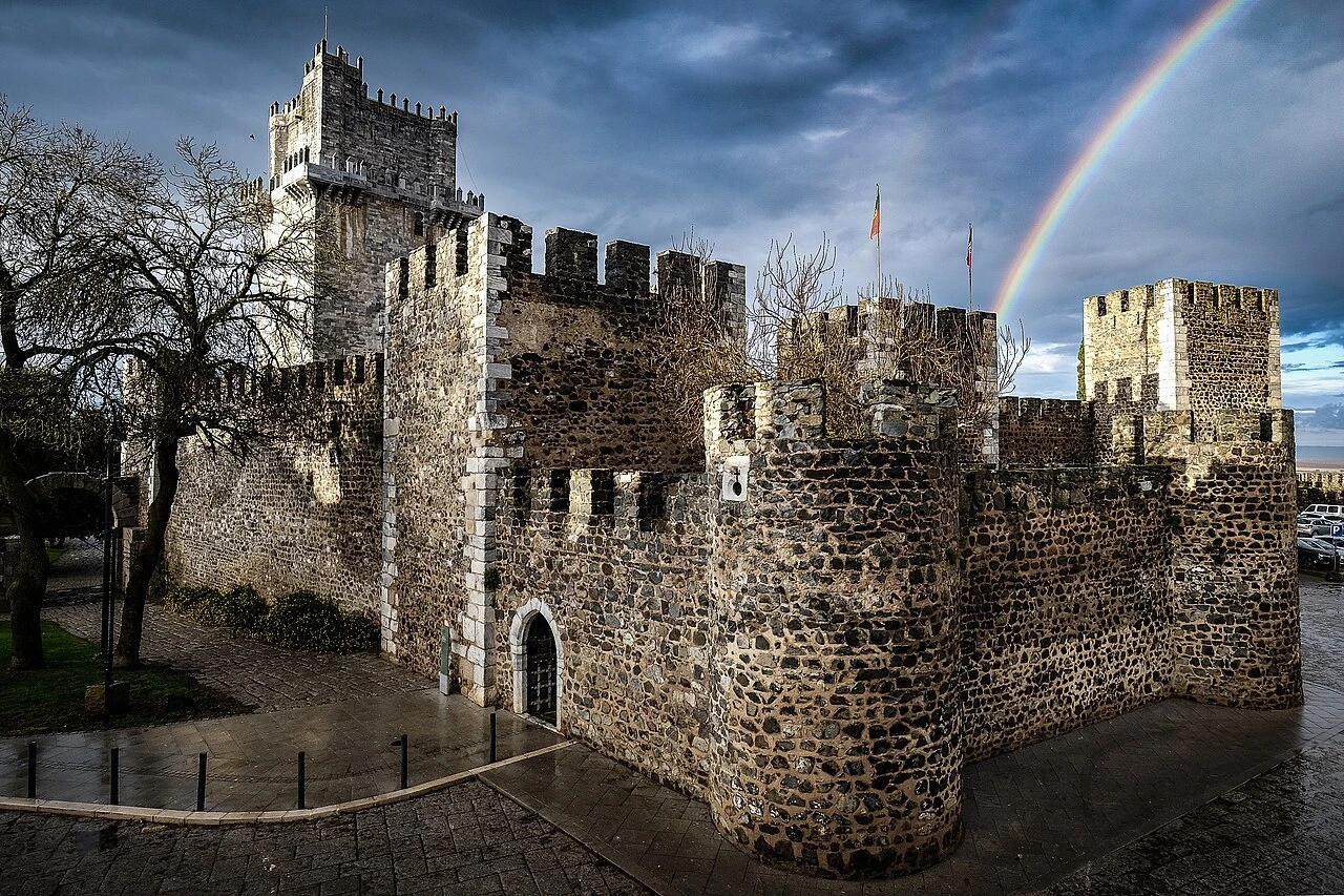
Beja
Castelo de Beja
Content & sources
Photo: Costajosemanuel.foto · CC BY-SA 4.0