Stanza · Audio guide
Citânia de BriteirosAudio guide
A place to remember. A story to take with you.
Citânia de Briteiros is a significant Iron Age hillfort and Roman archaeological site located near Guimarães. It is one of the most important pre-Roman settlements in the Iberian Peninsula.
Download Stanza, then search for “Citânia de Briteiros”.
About the tour
One guide. Your kind of visit.
Citânia de Briteiros is a significant Iron Age hillfort and Roman archaeological site located near Guimarães. It is one of the most important pre-Roman settlements in the Iberian Peninsula.
Ready when you are.
- 01Get the free Stanza app.
iOS & Android
- 02Find your guide.
“Citânia de Briteiros”
- 03Download before you go.
Works offline
Audio guide / 22 narrated stops
Inside the guide
Get to know a few of the stories before you go. Open a stop to read more.
01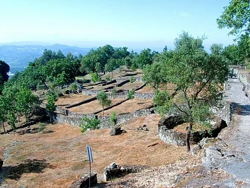 Arrival at the Defensive RampartsThe Ancient Hill Fort
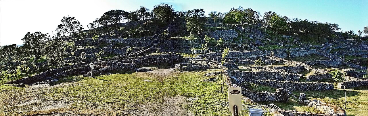
Welcome to Citânia de Briteiros, one of the most significant archaeological sites in the Iberian Peninsula. Located at an altitude of 336 meters on Monte de São Romão, this impressive hill fort was established between the fifth and fourth centuries BCE. Although the total site encompasses approximately 24 hectares, only about seven hectares are currently accessible for visitors to explore. From this elevated position, the extensive layout of stone foundations becomes apparent, revealing the complexity of the ancient urban planning. The ruins provide a unique window into the Castro culture, which flourished in the northwestern part of the peninsula before the arrival of the Romans. The site's position was not accidental; it offered natural defenses and commanding views of the surrounding valleys. Archaeologists have spent decades excavating these ruins, uncovering a world where stone and earth were shaped into a thriving community. As you look across the landscape, you can see the remains of walls, streets, and houses that once hummed with the activity of the Brácaros tribe. The scale of the foundations suggests a highly organized society capable of large-scale construction projects in a challenging mountain environment. Each stone you see was placed with purpose, contributing to a massive fortified town.
Fiore Silvestro Barbato from Napoli (NA), Italy · CC BY-SA 2.0
02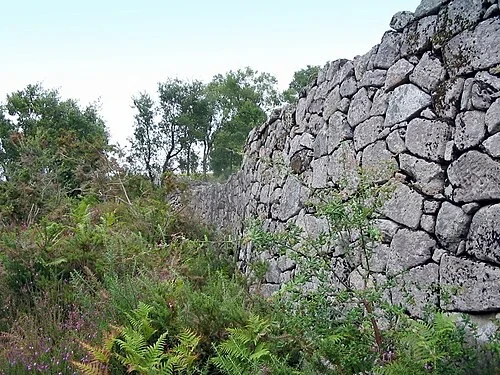 Arrival at the Defensive RampartsThe Defensive Ramparts
The military engineering of the Brácaros tribe is strikingly evident in these defensive ramparts. To protect their prominent settlement, the inhabitants constructed four distinct lines of walls that ringed the hill. These structures were built using a dry-stone masonry technique, where massive stones are carefully fitted together without the use of mortar or cement. This method required extreme precision to ensure the stability and strength of the wall against both the elements and potential attacks. In their original state, these walls likely reached several meters in height, creating an intimidating barrier for any approaching enemy. The sheer scale of the stones used in the lower courses speaks to the immense labor and coordination required for such a project. These defenses were essential for the security of the hundreds of families living within the fort, allowing them to control the surrounding territory with confidence. While today we see only the lower portions of these walls, they still convey a sense of the settlement's original power and isolation. The rugged texture of the stones, weathered by centuries of rain and wind, remains a visible reminder of the site's strategic importance during the Iron Age. The layout of the walls was designed to follow the natural contours of the hill, maximizing the defensive advantages of the steep slopes.
Photo: PePeEfe · CC BY-SA 3.0
03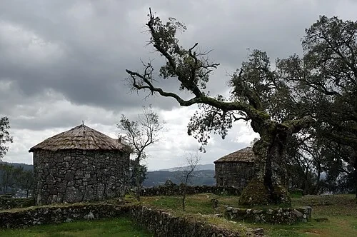 Reconstructed Iron Age DwellingsReconstructed Iron Age Dwellings
These two circular houses with their conical thatched roofs provide a visual reference for what the entire hilltop once looked like. They were reconstructed in the 1870s by archaeologist Francisco Martins Sarmento, who was a pioneer in the study of this site. His goal was to demonstrate the original appearance of the residential buildings to the public and fellow researchers. The houses are built using locally sourced granite for the thick, curved walls, reflecting the traditional construction methods of the Castro culture. The roofs are made of straw, a material that would have been readily available to the ancient inhabitants from the surrounding fields. This circular architectural style is the hallmark of hill forts in this region, designed to withstand the strong winds and harsh weather typical of high-altitude locations. Inside these structures, a single room would have served multiple purposes for a family, including sleeping and storage. The reconstruction helps bridge the gap between the low stone foundations seen elsewhere on the hill and the once-thriving living spaces of the Iron Age. Seeing these houses helps us appreciate the texture and scale of daily life for the Brácaros, contrasting the rough, gray stone with the golden, organic straw of the high conical roofs.
Listen in the appDonald Judge from England · CC BY 2.0
04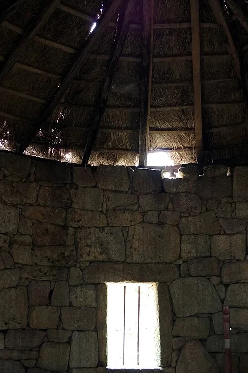 Reconstructed Iron Age DwellingsInside the Circular House
The interior of this circular house reveals the clever structural solutions used by the ancient builders. Notice the sturdy timber roof frame that radiates outward from a central point to support the heavy weight of the thatched straw. The thick stone walls provided excellent insulation, keeping the interior cool in the summer and trapping heat during the colder months. Interestingly, these houses were built without chimneys. Smoke from the central hearths would rise to the ceiling and slowly filter through the gaps in the straw roof, which also helped to waterproof the thatch by coating it in soot. Light and ventilation were limited, provided mostly by the doorway and small, narrow window openings like the one visible here. These slits in the masonry were kept small to maintain the home's defensive integrity and thermal efficiency. Living in such a space would have been an intimate experience, with the smell of woodsmoke and earth filling the air. The floor would have likely been made of compacted clay or stone slabs, and the space would have been shared between family members and essential supplies. This simple yet effective design allowed the Castro people to thrive in this rugged environment for centuries. The tight fit of the wall stones, even on the interior face, shows the high level of craftsmanship applied to everyday domestic architecture.
Listen in the appDonald Judge from England · CC BY 2.0
05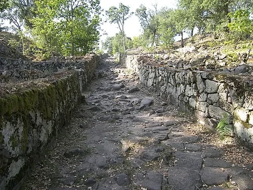 The Sophisticated Urban GridThe Paved Main Street
This paved main street is one of the most surprising features of Citânia de Briteiros. While many contemporary hill forts had chaotic or organic layouts, this site boasts a sophisticated urban grid that reflects deliberate planning. The streets are paved with flat granite stones, a feature that served a very practical purpose: preventing the paths from turning into mud during the rainy season. This paving allowed for easier movement of people, livestock, and goods across the steep terrain of the hill. The layout of the streets follows an orthogonal plan, meaning they intersect at right angles to create organized residential blocks. This level of organization is highly unusual for a proto-historic settlement and suggests a high degree of centralized authority and communal cooperation. Walking along these ancient stones, one can imagine the noise of daily life—the clatter of wooden wheels, the bleating of sheep, and the voices of neighbors. The width of the street allowed for two-way traffic in many areas, indicating its role as a major artery for the community. The stones themselves show signs of wear from centuries of use before the settlement was eventually abandoned. This street wasn't just a path; it was a fundamental part of the town's infrastructure, connecting the various family compounds to the main public and ritual areas of the fort.
Listen in the appPhoto: CTHOE · CC BY-SA 3.0
06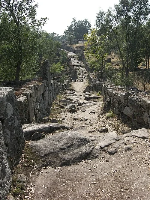 The Sophisticated Urban GridThe Residential Grid
From this perspective, the organization of the settlement into distinct residential blocks becomes clear. The paved streets act as borders, separating the foundations of various family compounds. Within these blocks, the social structure of the Brácaros tribe is visible in stone. While most individual houses were circular, they were rarely isolated; instead, they often shared a communal courtyard. These courtyards served as outdoor living spaces where families could work, cook, or socialize. Surrounding the main houses, you might see smaller rectangular foundations which were used as storage sheds, granaries, or workshops for crafts like weaving and pottery. This layout promoted a close-knit communal lifestyle while still providing individual families with their own defined spaces. The density of the buildings indicates a large population living in close proximity, which would have required clear rules for the use of space and resources. The shared walls between some structures suggest that families may have expanded their living areas over generations. As you look at the maze of foundations, you are seeing the footprint of a complex society that balanced private family life with the needs of a large, fortified town. Each compound was a self-sufficient unit, yet deeply integrated into the larger grid of the hill fort, reflecting a sophisticated balance of social organization.
Listen in the appPhoto: CTHOE · CC BY-SA 3.0
07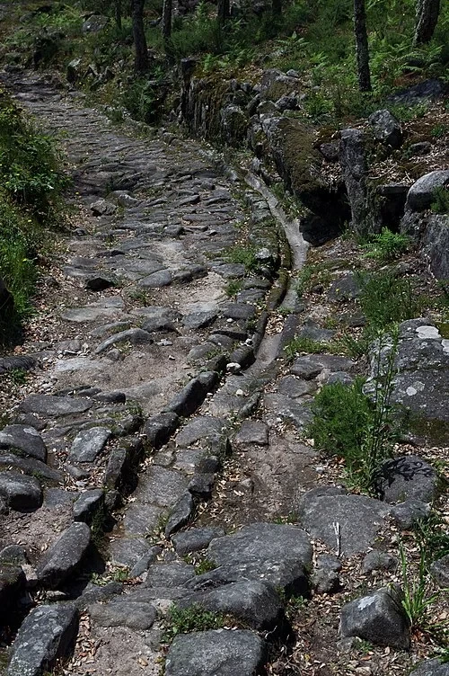 Hydraulic Engineering and DrainageAncient Stone Gutters
The hydraulic engineering at Citânia de Briteiros is exceptionally advanced for its time. Notice the narrow channel carved directly into the granite paving stones of the street. This system was designed to handle the heavy rainfall common in northern Portugal. Without these gutters, the steep streets would have quickly eroded, and water would have flooded into the low-lying houses. The drainage system acted as a network of veins, channeling rainwater away from the residential compounds and down the slopes of the hill. This kept the living areas dry and the streets passable even during intense storms. The precision with which these channels were cut into the hard granite is a testament to the skill of the local stonemasons. They had to account for the natural slope of the hill to ensure that water would flow continuously rather than pooling in the streets. This infrastructure shows that the inhabitants were not just building houses; they were managing their environment with foresight. Such drainage systems are more commonly associated with later Roman urban planning, making their presence here in a proto-historic context even more remarkable. The existence of these gutters highlights the community's investment in public works that benefited everyone, ensuring the longevity and health of the settlement. The wear inside the channels suggests they functioned for many generations, carrying water away from the heart of the town.
Listen in the appDonald Judge from England · CC BY 2.0
08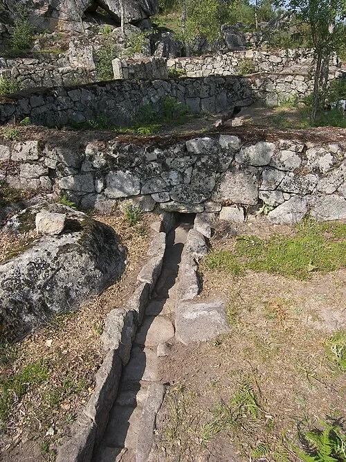 Hydraulic Engineering and DrainageDrainage Infrastructure
This specific stone-lined drainage channel shows how the town’s hydraulic network was integrated into the very foundations of the buildings. Every street and private courtyard was connected to a series of these troughs. To create such a system, the builders had to carve long, straight channels into hard granite using only iron tools. This required immense effort and a clear understanding of levels and gravity. Notice how the channel passes through the base of a wall, showing that the drainage was planned before or during the construction of the residential compounds. By moving water under or through walls, the builders kept the ground stable and prevented the accumulation of dampness that could weaken the structures over time. This level of technical detail suggests that specialized workers may have been responsible for the town's infrastructure. The system was designed to be low-maintenance, relying on the natural incline of Monte de São Romão to keep the water moving. It is a brilliant example of functional engineering that remains visible thousands of years later. The way the stones are fitted around the channel demonstrates a high level of masonry skill, ensuring that the water stayed within its path. This infrastructure was vital for maintaining the cleanliness and structural integrity of a densely populated hill fort where dozens of houses were built in close proximity to one another.
Listen in the appPhoto: CTHOE · CC BY-SA 3.0
09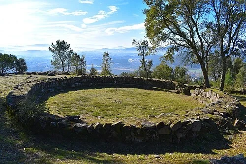 The Council House (Casa do Conselho)The Council House
You are looking at the 'Casa do Conselho,' or Council House, which was the political and social center of the community. With a diameter of approximately 11 meters, it is the largest circular structure discovered at Citânia de Briteiros. Unlike the smaller private dwellings, this building was designed for public life. It was here that the elders and leaders of the Brácaros tribe would meet to discuss important matters, from tribal laws and land disputes to trade and defense strategies. The size of the building reflects its importance, capable of holding a significant number of people for these deliberations. Its central location within the settlement ensured that it was accessible to everyone, yet its scale marked it as a place of authority. Archaeological evidence suggests that such buildings were common in Castro culture settlements, serving as a venue for consensus-based decision-making. The circular shape is significant, as it allowed everyone inside to see and hear each other clearly, facilitating open dialogue. This house represents the birth of local political institutions in the region, long before the centralization of power brought by foreign empires. Standing by these wide foundations, one can imagine the intense discussions that once took place here, shaping the future of the thousands of people who called this hill fort their home.
Listen in the appPhoto: Bextrel · CC BY-SA 4.0
10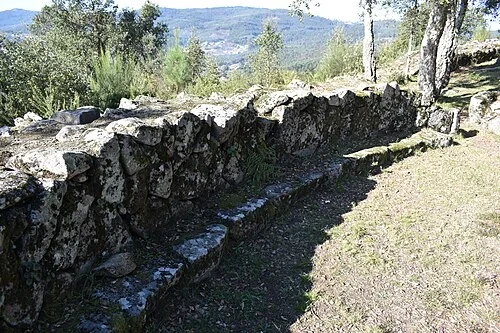 The Council House (Casa do Conselho)The Elders' Bench
Inside the Council House, a continuous stone bench runs along the entire interior perimeter. This seating arrangement is a fascinating physical manifestation of the tribe's social order. By having everyone sit in a circle on an identical bench, the layout facilitated group discussion and promoted a sense of equality among the participants. There is no 'head seat' or throne, which suggests that leadership among the Brácaros may have been more collaborative and based on consensus rather than the absolute rule of a single individual. Each elder would have had a place on this bench, looking across the room at their peers during debates and ceremonies. This arrangement ensured that every voice could be heard and that decisions were made in view of the entire group. The bench itself is made of thick granite slabs, built to last as long as the laws they discussed. It reflects a form of local governance that valued dialogue and the wisdom of the community's elders. Even today, the bench remains remarkably well-preserved, allowing us to visualize the physical setting of ancient political life. This space was likely where traditions were passed down and the collective memory of the tribe was maintained through oral storytelling and debate. The simplicity of the design underscores the practical, community-focused nature of the Brácaros' political system, where every member of the council held a literally equal footing.
Listen in the appPhoto: Bextrel · CC BY-SA 4.0
Citânia de Briteiros
Frequently asked questions
How much does the guide cost?
Free app download. Listed guide price: $3.99. Guide price shown in the app. Audio guide only. Venue admission is separate.
Can I listen without internet?
Yes. Download the guide’s audio, images, and maps in the app before your visit. Your downloaded content is then available offline.
Can I listen in my language?
Stanza supports 15 languages. Check the app for the languages available for this guide.
Do I need to follow a schedule?
No. This is a self-guided experience. Choose your stops, pause whenever you like, and return to a story at your own pace.
At your own pace
Explore Citânia de Briteiros.
Download Stanza, then search for “Citânia de Briteiros”.
Free app download · Guide price shown in the app
Keep exploring
Nearby audio guides
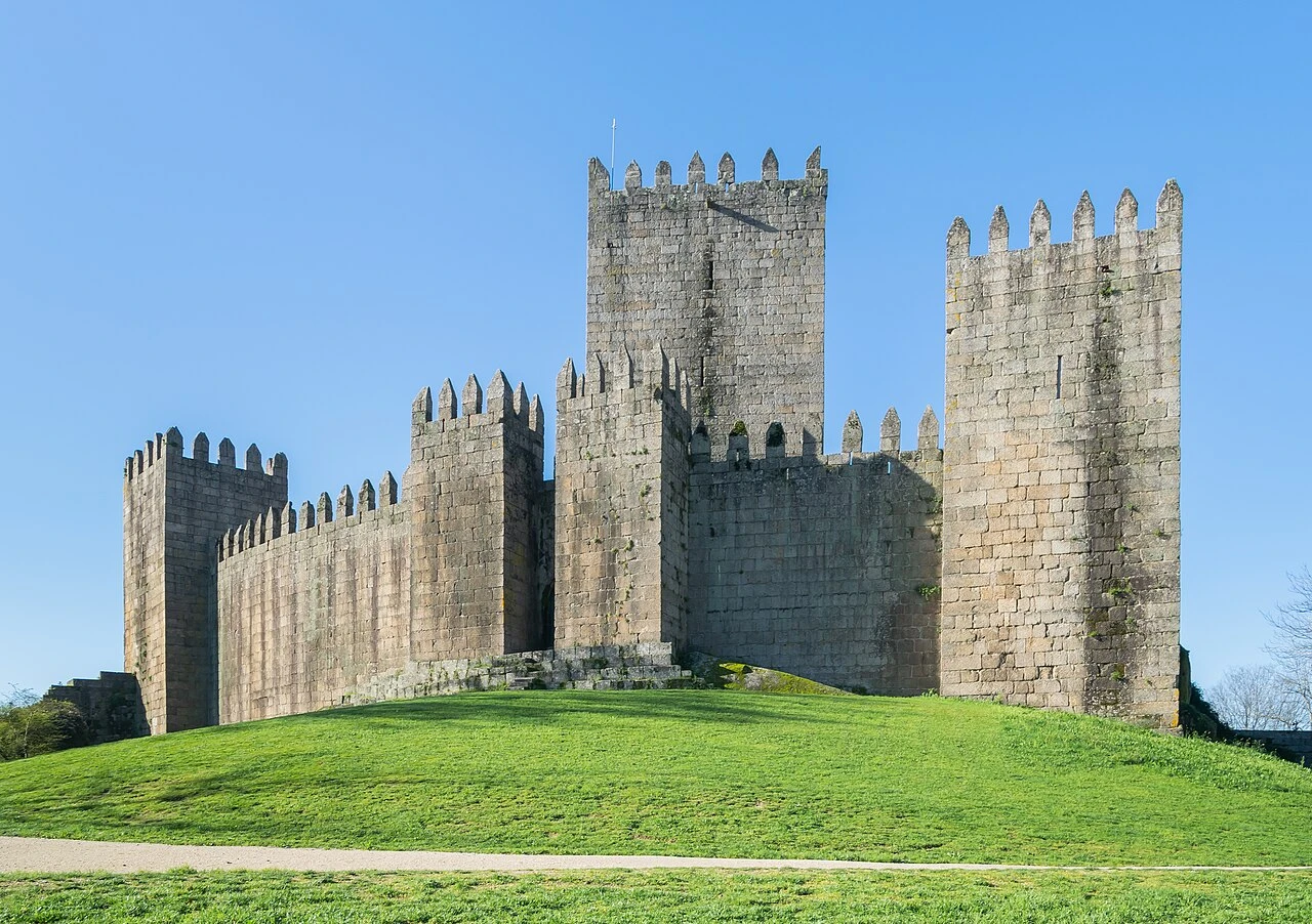
Guimarães
Castelo de Guimarães
Content & sources
Krzysztof Golik · CC BY-SA 4.0
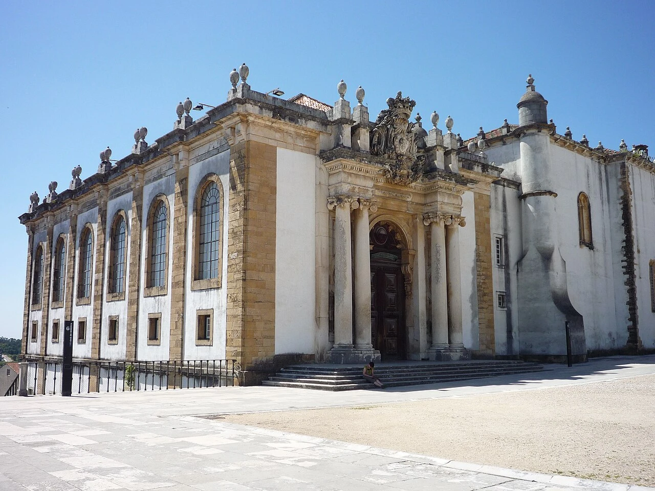
Coimbra
Biblioteca Joanina
Content & sources
Chris · CC BY-SA 2.0
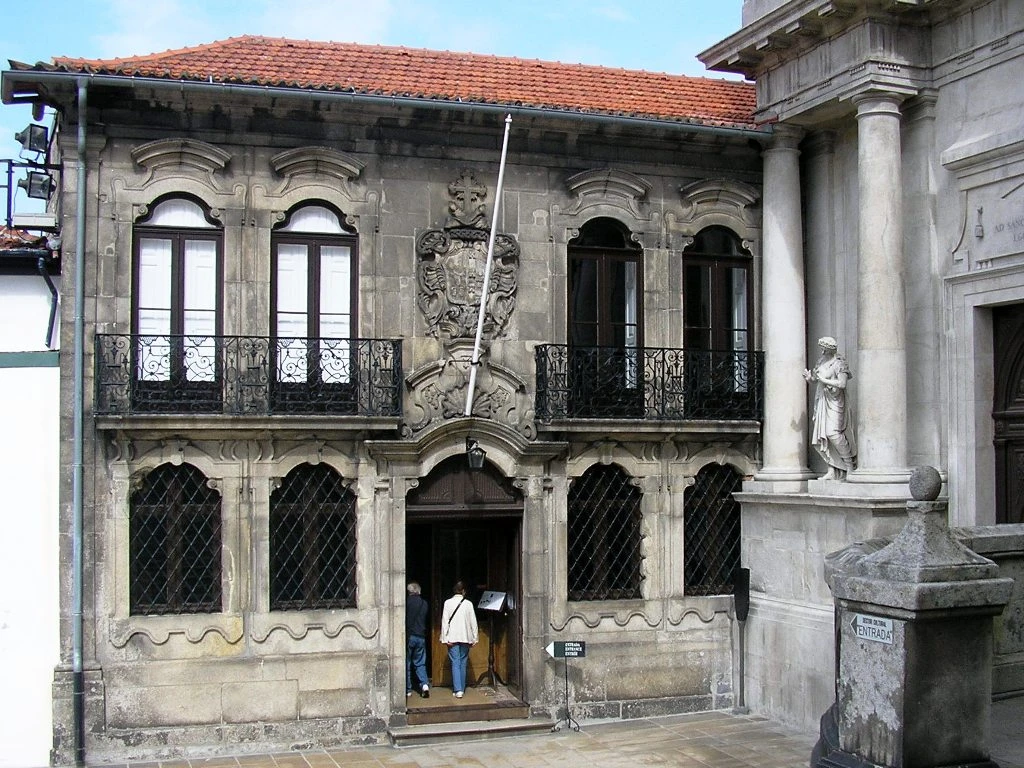
Porto
Casa do Despacho da Venerável Ordem Terceira de São Francisco
Content & sources
Photo: Manuel de Sousa · CC BY-SA 3.0
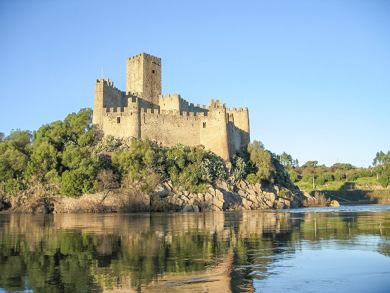
Praia do Ribatejo
Castelo de Almourol
Content & sources
Daniel Feliciano · CC BY-SA 2.5