Stanza · Audio guide
Ακροκόρινθος Audio Guide
A place to remember. A story to take with you.
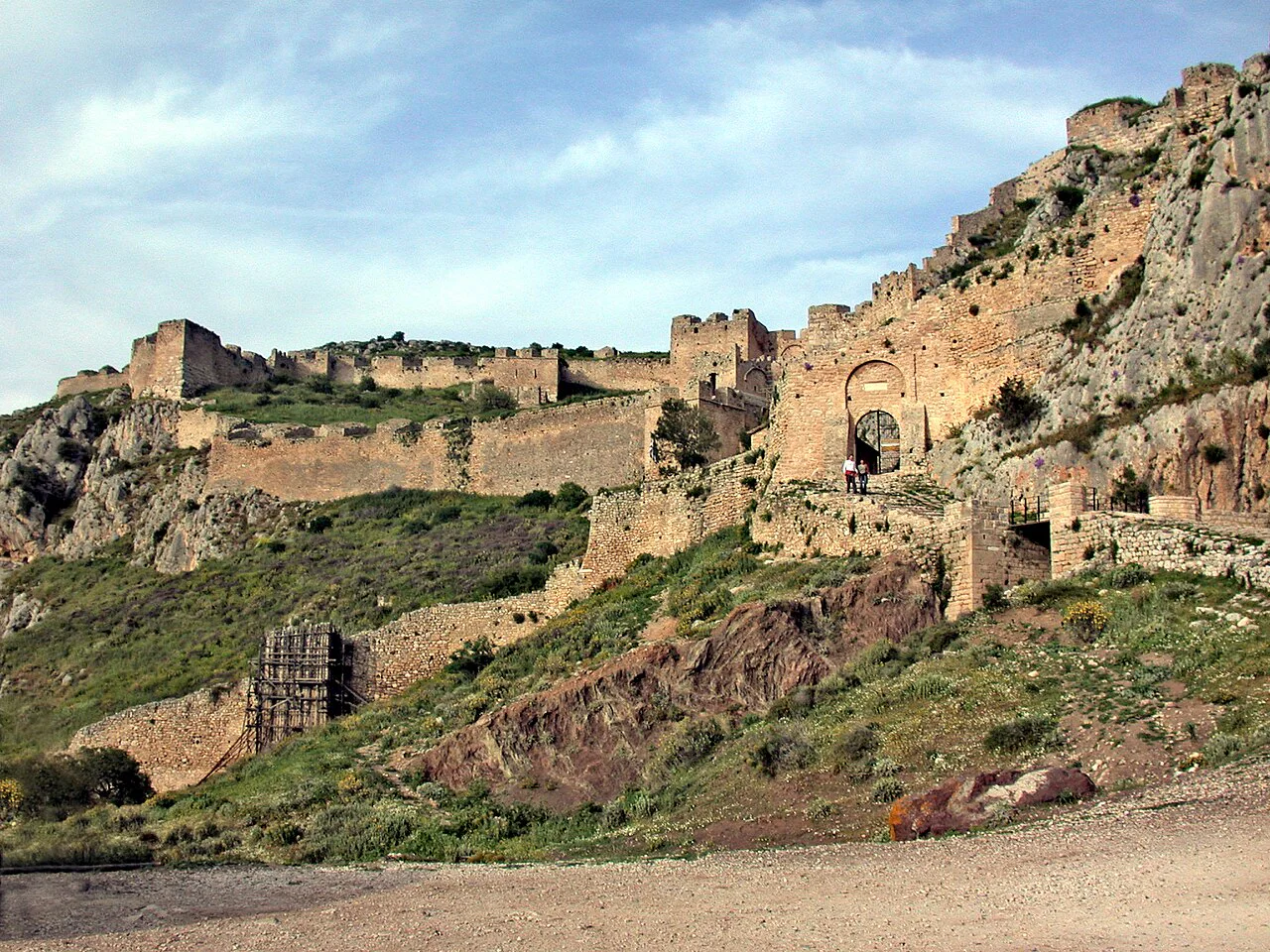
Acrocorinth is a monolithic rock overlooking the ancient city of Corinth, Greece. It is considered the most impressive of the acropolis of mainland Greece.
Download Stanza, then search for “Ακροκόρινθος”.
About the tour
One guide. Your kind of visit.
Acrocorinth is a monolithic rock overlooking the ancient city of Corinth, Greece. It is considered the most impressive of the acropolis of mainland Greece.
Ready when you are.
- 01Get the free Stanza app.
iOS & Android
- 02Find your guide.
“Ακροκόρινθος”
- 03Download before you go.
Works offline
Audio guide / 13 narrated stops
Inside the guide
Get to know a few of the stories before you go. Open a stop to read more.
01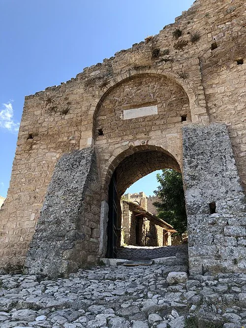 The Western Approach and Outer Gateways
First Gate and the Approach Path
Acrocorinth is a steep rock rising about five hundred and seventy-five metres above the plain of Corinth. Its name means Upper Corinth, and the ancient city lay at its northern foot. George Forrest judged it the most impressive acropolis on mainland Greece. The Corinthian tyrants Cypselus and his son Periander first fortified the rock in the seventh and sixth centuries BC. Over time the defences grew into a full acropolis. The only way up is a single winding track, and the town below cannot see it. Its walls and gates are arranged on three levels, and the first gate stands on the lowest. It is a high vaulted arch, with a plain panel set above it. Old accounts say a deep ditch once lay in front of this gate, crossed by a movable bridge. From up here, a raid from central Greece or from the sea could be seen coming.
Photo: Hadrianus · CC BY-SA 4.0
02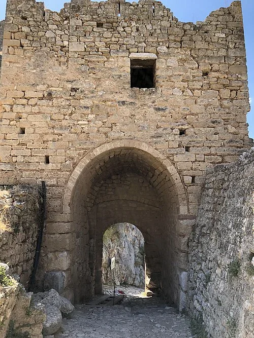 The Western Approach and Outer Gateways
Second Vaulted Gate
About a hundred metres further up the slope, the path reaches a second vaulted gate. The wall around it is larger than the wall around the first gate. A small window is set high in the tall masonry above the arch. Beyond the gate, the road turns into a broad spiral that climbs the rock. The spiral leads up to the main gate of the citadel on the upper level.
Photo: Hadrianus · CC BY-SA 4.0
03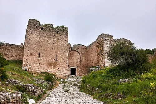 The Third Gate and Northern Artillery Ramparts
Main Gate of the Upper Citadel
The upper citadel was the last of the three lines of defence. A square tower stands beside an arched doorway, and a cobbled path climbs toward it. The Byzantines rebuilt the fortress from about the year 350. Justinian carried out a repair in the sixth century, and more additions followed into the twelfth century. Over time the citadel became the seat of the strategos. He was the military governor of the province of Hellas, and later of the Peloponnese. The walls enclose the whole plateau, which is split into a western and an eastern part. In 1458 Mehmed the Second, called the Conqueror, took the castle from its Byzantine defender, Matthaios Asan.
Listen in the appPhoto: George E. Koronaios · CC BY-SA 4.0
04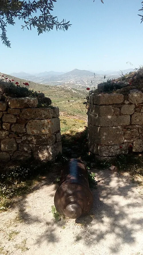 The Third Gate and Northern Artillery Ramparts
Cannon Between Stone Walls
After the Ottomans, the Venetians took the castle in 1687. They repaired it and gave it the shape it has today. Some cannon on the rock are attributed to that last Venetian period, under Francesco Morosini. One of them is dated 1670. The cannon lying between two stone walls shows no date, so it cannot be matched with that one. Beyond the walls, hills roll down toward the valley. In 1715 the Ottomans besieged the castle and took it.
Listen in the appΆρτεμις Ντούζου · CC BY-SA 4.0
05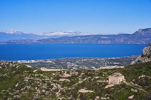 The Third Gate and Northern Artillery Ramparts
View Toward the Corinthian Gulf
Standing over the Isthmus of Corinth, the fortress turned back enemies trying to enter the Peloponnese by land. That made the rock a last line of defence in southern Greece, used again and again. In the Hellenistic period, it was one of the Fetters of Greece, three fortresses that kept the Greek city-states under Macedonian control. The others were Demetrias and Chalcis. The Macedonians had repaired and strengthened the walls in the fourth century BC. From one of the rock's higher levels, the view reaches over the Gulf of Patras and the Corinthian Gulf. It also takes in the southern shores of central Greece. Snow-capped mountains rise beyond the water, and towns line the coastal plain below. Farther off, the western Saronic Gulf reaches toward Salamis and Aegina.
Listen in the appPhoto: George E. Koronaios · CC BY-SA 4.0
06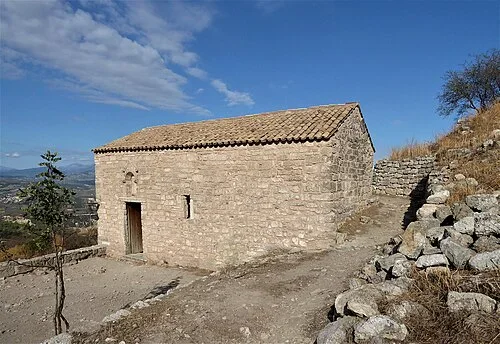 The Lower Plateau: Village and Sanctuaries
Church of Agios Dimitrios
A small stone chapel carries the name Agios Dimitrios. It has a tiled roof and a wooden door, and a rough track leads up to it past a wall of piled stones. Older accounts mention a chapel of the Prophet Elias among the remains on the rock, and it is not clear whether this is that building. The rest of the rock holds ruins of older towers, underground passages, wells, storerooms and cisterns. Many generations of people worked on these structures, building, finishing and repairing them.
Listen in the appPhoto: Chris06 · CC BY-SA 4.0
07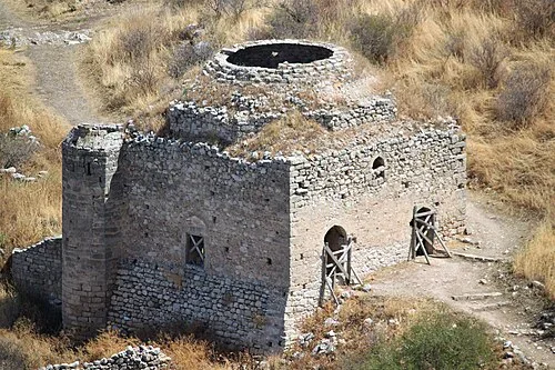 The Lower Plateau: Village and Sanctuaries
Ahmed III Mosque Ruins
Sultan Ahmed the Third commissioned this mosque, and today it lies mostly in ruins. The Ottoman rule that built this mosque ended in the war of the 1820s. Greek fighters held the castle from 1821. In July 1822 Dramali Pasha retook it without a fight, because its defenders had already left. After his defeat at the Battle of Dervenakia, Dramali came back to Acrocorinth. He died there a few months later, slowly wasting away. A surrender treaty was signed in October 1823. The Ottoman men stayed on until an inventory was made of the goods that would pass to the Greeks. On the feast of Saint Demetrius, the garrison finally withdrew. Three hundred Turkish-Albanian soldiers handed the rock to the Greeks. Sixty women went with them.
Listen in the appPhoto: Iolchos07 · CC BY-SA 4.0
08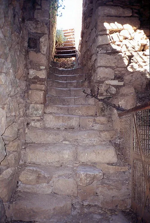 The Upper Peirene Spring
Steps Toward the Upper Peirene
The water cistern known today as the Dragonera is, according to the writer Pausanias, the ancient Peirene. The spring lies within the encircling walls of the rock, and it is now called the Upper Peirene. These narrow steps are said to belong to that spring area. They climb between high walls, with a metal railing along one side and daylight showing at the top.
Listen in the appMark Landon (User:Choliamb) · CC BY 4.0
09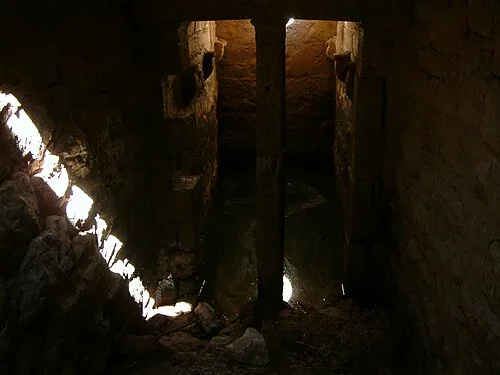 The Upper Peirene Spring
Upper Peirene Cistern
Asopus, a river god, was searching for his daughter Aegina, whom Zeus had carried off. Sisyphus knew where she was. He would reveal it only if he was given a spring on the rock, and Asopus gave him one, the legend says. A dark, stone-walled chamber has a central pillar, water on the floor, and light falling in from openings above. A secure water supply on a bare rock was no small matter, and it helped the fortress serve as a stronghold that could be counted on.
Listen in the appPhoto: Zde · CC BY-SA 4.0
10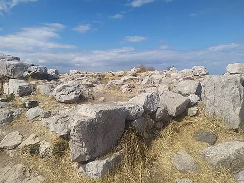 The Summit: Sanctuary of Aphrodite
Temple of Aphrodite at Acrocorinth
The highest point of the rock once held a temple to Aphrodite, the protector goddess of Corinth. According to one myth, the sun god Helios gave the rock itself to her. The temple was built in the fifth century BC, and it was a relatively small building. Of the goddess's sanctuaries in the city, this one on the summit was the most famous. Inside stood a statue of Aphrodite in armour, holding a shield before herself as a mirror.
Listen in the appPhoto: Vanbasten 23 · CC BY-SA 3.0
- 11
Summit Stone Foundations
The summit's stone foundations, where a temple became a church and later a mosque.
- 12
Frankish Tower
The defender who held the rock against the Crusaders for three years, and the Franks who took it in 1210.
- 13
Fortified Peak Seen from Afar
A distant rocky peak, and why people kept coming back to Acrocorinth for refuge, command and worship.
Ακροκόρινθος
Frequently asked questions
How much does the guide cost?
Free app download. Listed guide price: $1.99. Guide price shown in the app. Audio guide only. Venue admission is separate.
Can I listen without internet?
Yes. Download the guide’s audio, images, and maps in the app before your visit. Your downloaded content is then available offline.
Can I listen in my language?
This audio guide is available in 15 languages, including English.
Do I need to follow a schedule?
No. This is a self-guided experience. Choose your stops, pause whenever you like, and return to a story at your own pace.
At your own pace
Explore Ακροκόρινθος.
Download Stanza, then search for “Ακροκόρινθος”.
Free app download · Guide price shown in the app
Keep exploring
Nearby audio guides
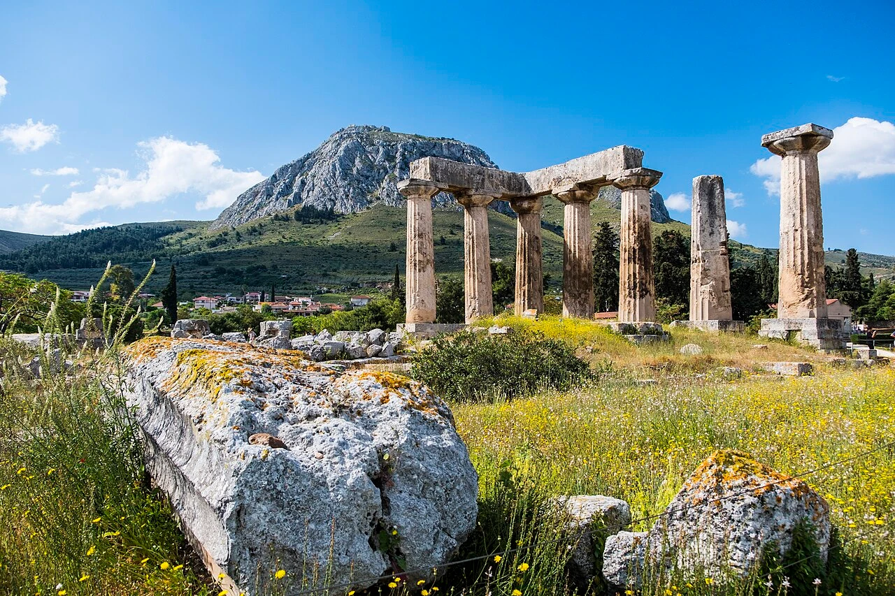
Corinth · 2 km
Ancient Corinth
Content & sources
Davide Mauro · CC BY-SA 4.0
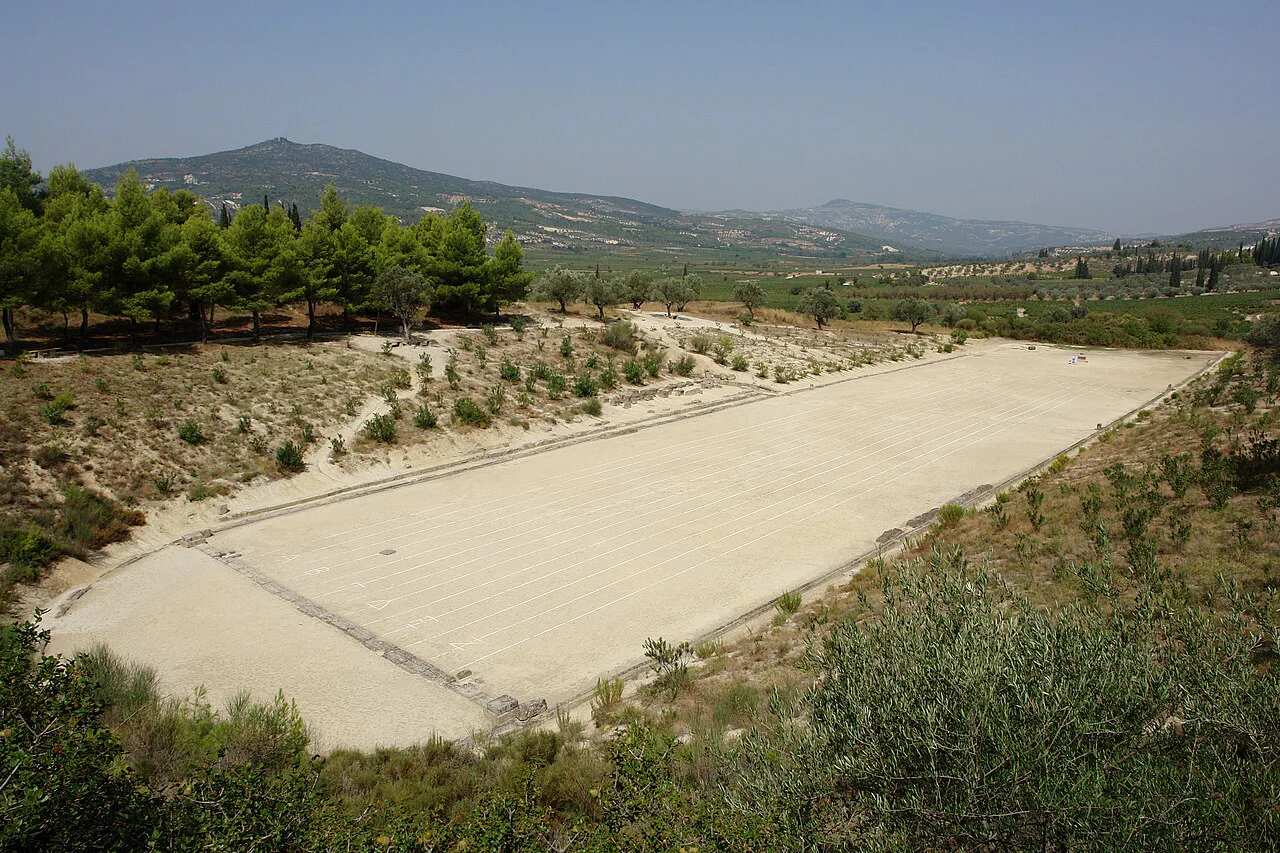
Nemea Municipality · 17 km
Αρχαία Νεμέα
Content & sources
Michael F. Mehnert · CC BY-SA 3.0
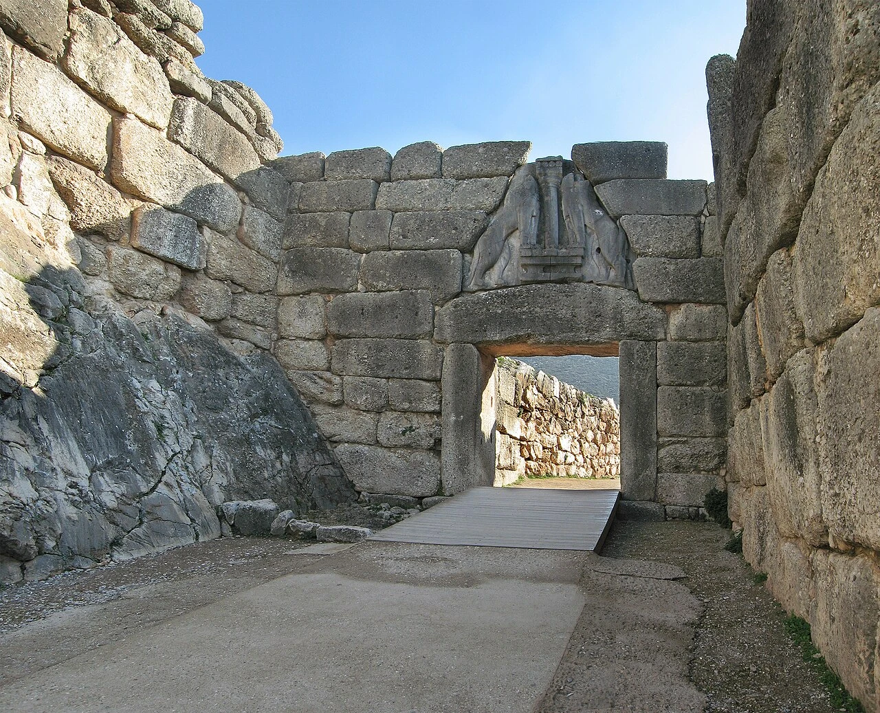
Mycenae · 21 km
Mycenae Archaeological Site
Content & sources
Andreas Trepte · CC BY-SA 2.5
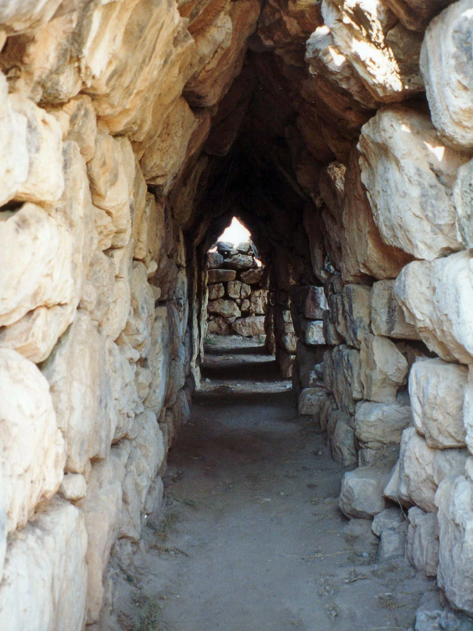
Nafplio · 33 km
Tiryns
Content & sources
Alun Salt · CC BY-SA 2.0