Stanza · Audio guide
Altun Ha Audio Guide
A place to remember. A story to take with you.
Altun Ha is the name given to the ruins of an ancient Maya city in Belize. The site covers an area of about 8 square kilometres.
Download Stanza, then search for “Altun Ha”.
About the tour
One guide. Your kind of visit.
Altun Ha is the name given to the ruins of an ancient Maya city in Belize. The site covers an area of about 8 square kilometres.
Ready when you are.
- 01Get the free Stanza app.
iOS & Android
- 02Find your guide.
“Altun Ha”
- 03Download before you go.
Works offline
Audio guide / 9 narrated stops
Inside the guide
Get to know a few of the stories before you go. Open a stop to read more.
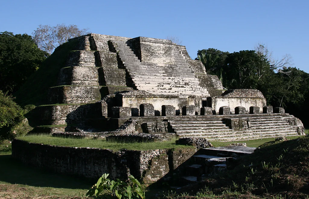
01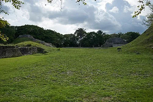 Plaza A (The Classic Plaza)
Arrival at Altun Ha: A Maya City on the Coastal Plain
Welcome to Altun Ha, an ancient Maya city in the lowlands of Belize. Its name means Rockstone Water, a Yucatec Mayan rendering of the nearby village, Rockstone Pond. Haltun in that language is a stone basin that holds water, and ha simply means water. People lived here for nearly two thousand years, from about 900 B.C. to A.D. 1000. The city covered roughly eight square kilometres, about fifty kilometres north of Belize City and only ten from the Caribbean shore. That position by the sea shaped everything that happened here, as a trading and ceremonial centre linking the coast with the inland Maya world. For a long time the ruins went unnoticed by outsiders. Villagers even carried off stones from the old structures to build houses in the modern village. Only in 1963 did the ancient city finally come to the attention of archaeologists.
Photo: Denis Barthel · CC BY-SA 4.0
02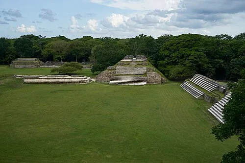 Plaza A (The Classic Plaza)
Plaza A: The Classic Plaza
The broad open plaza at Altun Ha was the stage for the city's public life. Here crowds gathered for ritual and ceremony, framed by stepped platforms rising on every side. The city reached its largest extent in the Classic period, between about A.D. 400 and 900. Most of what is known about Altun Ha comes from those five centuries. Building work tells its own story about where importance lay. By A.D. 700, changes in the central precinct had become rare, and only a couple of structures in Plaza B were still being touched. Plaza A, though, kept being modified extensively. Long after the city's busiest days, the people here were still investing in this plaza. It remained the heart of communal life to the very end.
Photo: Denis Barthel · CC BY-SA 4.0
03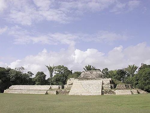 Structure A1 (Temple of the Green Tomb)
Structure A1: Rediscovering Altun Ha
This restored pyramid owes its tidy face to one of the great modern digs in the Maya lowlands. Early on, the site was known simply as Rockstone Pond, after the village. Then in 1963, villagers quarrying near the ruins pulled a large, elaborately carved jade pendant out of the ground. The commissioner of archaeology at the time, Hamilton Anderson, heard about it and notified David M. Pendergast. A reconnaissance trip followed that same year. In 1964, a team from the Royal Ontario Museum led by Pendergast began extensive excavations and restorations. The work ran through 1970, some forty months of fieldwork in all, with a final season in 1971 devoted to laboratory analysis of the ceramics. The structures around this plaza were uncovered and rebuilt by that campaign. What had been a nameless mound became one of Belize's best-known ancient sites.
Listen in the appThe original uploader was Aquaimages at English Wikipedia. · CC BY-SA 2.5
04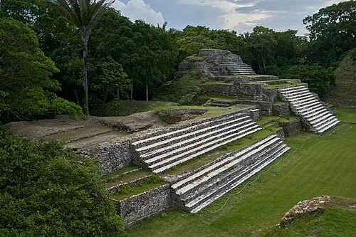 Structure A1 (Temple of the Green Tomb)
Wealth in Jade and from the Sea
The long stairways and terraces of these buildings held burials of the city's elite, and those burials explain where Altun Ha's wealth went. More than 800 pieces of jade have come out of this site, over 60 of them carved. In the Late Classic, elite graves here were marked above all by generous amounts of jade. The sea paid the other half of the bill. The people of Altun Ha ate a maize-based diet, like Maya everywhere, but with an unusually large share of marine food compared with other Maya sites. Reef and coastal resources mattered more here than anywhere else in the region. That ready supply of seafood, drawn from the Caribbean just a few kilometres away, fed the population and helped underwrite the city's role as a coastal trading power.
Listen in the appPhoto: Denis Barthel · CC BY-SA 4.0
05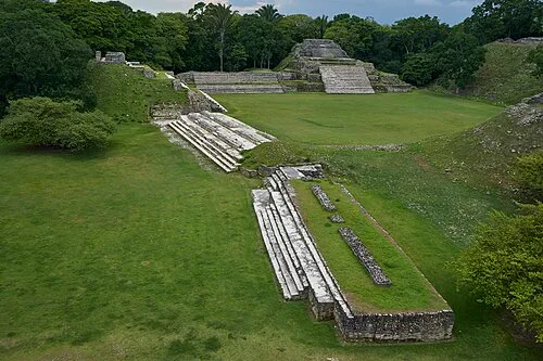 Plaza B (The Central Plaza)
Plaza B: Gateway to Distant Empires
One of the most important Early Classic finds at Altun Ha came from a single burial. Structure F8 was built around A.D. 200, and about fifty years later a tomb was cut into it. Inside lay an adult male with a jade and shell necklace, jade earflares, two pearls, five pottery vessels and fifty-nine valves of Spondylus shell. Above the burial, the builders sealed it with a vast ritual offering. It held more than 8,000 chips of chert and 163 finished chert tools. The decisive evidence came from 248 objects of Pachuca green obsidian, along with 23 ceramic jars, bowls and dishes. That green obsidian comes from a single source in central Mexico, near the great metropolis of Teotihuacan, more than a thousand kilometres from here. The burial points to ties between Altun Ha's rulers, or perhaps the whole community, and central Mexico at the height of that city's influence.
Listen in the appPhoto: Denis Barthel · CC BY-SA 4.0
06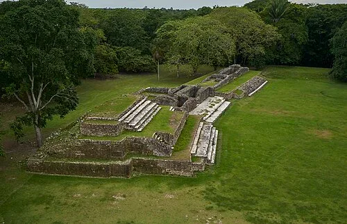 Plaza B (The Central Plaza)
The Panama Gold Claw: Trade Beyond the Horizon
One small bead from an offering in the central ceremonial precinct changed what scholars thought the Maya could reach. The deposit dates to about A.D. 500. It held a lidded limestone vessel containing jadeite objects, two pearls, laminae of crystalline hematite and Spondylus shell beads. At the bottom lay a bead of tumbaga, a gold-copper alloy, shaped like a jaguar claw. The bead is identical to metalwork of the Coclé culture of central Panama. For a long time it was believed the Classic-period Maya had no gold at all, reserving metalwork for later centuries. This single artifact overturned that idea. It also showed that trade networks were reaching deep into Central America far earlier than anyone had thought, with the Coclé metalworkers surely playing a part in the exchange.
Listen in the appPhoto: Denis Barthel · CC BY-SA 4.0
07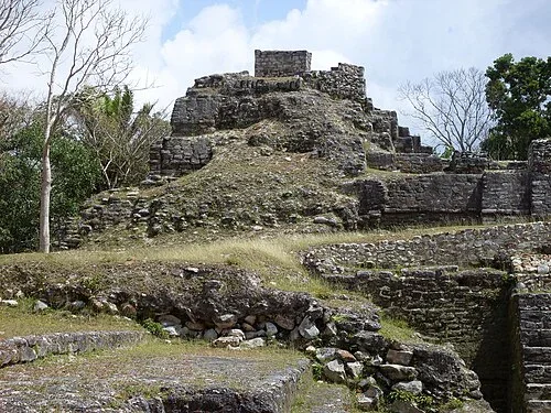 Temple of the Masonry Altars (Structure B-4)
The Temple of the Masonry Altars
Rising above the plazas stands the largest temple-pyramid at Altun Ha, the Temple of the Masonry Altars. It reaches sixteen metres, fifty-two feet, high. The building was not raised in a single effort. Its builders wrapped each earlier stage inside the next, rebuilding the temple over and over across generations, level upon level. Each phase enclosed the one before it, so the whole structure is a stack of older temples. The silhouette became so familiar in Belize that a drawing of this very temple is the logo of the country's leading beer, Belikin. From the platform at its summit, the whole ancient city spreads out below.
Listen in the appPhoto: Dylanpack · CC BY-SA 3.0
08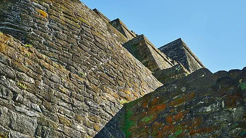 Temple of the Masonry Altars (Structure B-4)
The Sun God's Tomb and the Giant Jade Head
Against this weathered masonry lies the story of the richest burial ever found at Altun Ha. In the 1968 field season, excavators working through the temple's construction phases reached the seventh level, dated to about A.D. 600 to 650. It held the earliest and most elaborate tomb in the whole structure, nicknamed the Sun God's Tomb. Inside lay an adult male, fully extended, with 43 non-perishable offerings around him. Ceramic bowls, shell beads, jadeite anklets and bracelets, pearls, pyrite and hematite all accompanied the body. The most outstanding object was a giant carved jade head, nearly fifteen centimetres high and weighing about four and a half kilos. It had been placed at his pelvis, its carved face turned toward his skull. For decades it was identified as Kinich Ahau, the Maya sun god. Newer research suggests it may instead be a Jester God, an early symbol of Maya rulership, or a bird deity with maize imagery. With so much jade at the site, Pendergast even proposed the head may have been carved here from imported stone.
Listen in the appPhoto: Georg Karl Ell · CC BY-SA 4.0
09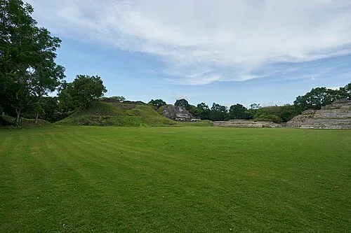 The Ancient Reservoirs and Exit
Water for a City, and the Long Goodbye
A city of this size needed water, and the coastal plain offered almost none. In ancient times the ground here was very swampy, in a dry tropical zone with hardly any recognizable water sources. The only natural one today is a creek beyond the northern edge of the site. So the people of Altun Ha engineered their own supply. Gordon Pond served as the main reservoir, and the Camp Aguada sat in the very centre of the site. That ingenuity carried the city for centuries, along with trade routes that stretched from the Caribbean to central Mexico and Panama. The end came slowly rather than suddenly. Gradual abandonment began around A.D. 800, though one outlying zone actually reached its peak between 700 and 800. By 850, some structures stood completely empty, and the city faded entirely by about A.D. 1000. Altun Ha remains a place where a swamp became a city, and a small town traded with an empire.
Listen in the appPhoto: Denis Barthel · CC BY-SA 4.0
Altun Ha
Frequently asked questions
How much does the guide cost?
Free app download. Listed guide price: $0.99. Guide price shown in the app. Audio guide only. Venue admission is separate.
Can I listen without internet?
Yes. Download the guide’s audio, images, and maps in the app before your visit. Your downloaded content is then available offline.
Can I listen in my language?
This audio guide is available in 15 languages, including English.
Do I need to follow a schedule?
No. This is a self-guided experience. Choose your stops, pause whenever you like, and return to a story at your own pace.
At your own pace
Explore Altun Ha.
Download Stanza, then search for “Altun Ha”.
Free app download · Guide price shown in the app
Keep exploring
Nearby audio guides
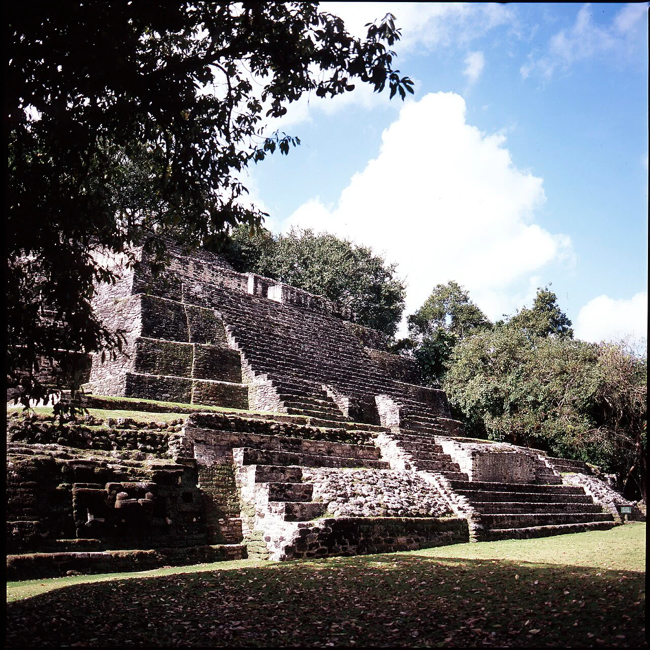
Indian Church · 32 km
Lamanai
Content & sources
Photo: Urbanarcheology · CC BY 3.0
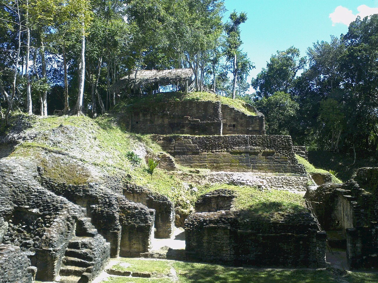
Melchor de Mencos · 120 km
Naranjo
Content & sources
Photo: Rudy Canales · CC BY-SA 3.0
Lázaro Cárdenas · 138 km
Chacchobén
Content & sources
-Luyten- · Public domain
Cayo District · 138 km
Caracol
Content & sources
Devon Jones · CC BY-SA 3.0